Product Introduction
GyoroviewWhitebase
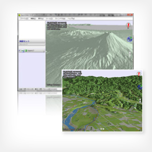
It is a function to display a 3D white map.
It can be expressed in 3D anywhere in Japan.
Announcement
April, 1st 2012 We started sell.
Concept
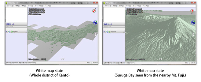
GyoroViewWhiteBase is a function to display a 3D white map.
It can be expressed in 3D anywhere in Japan.
Characteristics
- The topography data maintenance based on 10mDEM issued by the Ministry of Land, Infrastructure, Transport and Tourism.
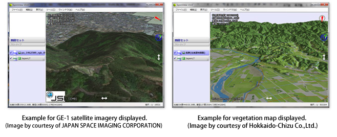
- Your drawings, satellite imagery and aerial photography can be displayed in 3D.
There is no need to develop new 3D data. - Switching to 3D display is only "click the 3D icon".
Examples of use
- It is useful for checking your image or map in 3D.
- You can see tracking locus and waypoint in 3D.
- It can be used as a 3D viewer that works with existing GIS systems.
Future extensions
Going forward, we will sequentially provide the following functions.
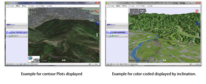
- Geomorphological analysis function that display inclination distribution and longitudinal section, cross section.
- Road network design support function
Price
Please contact us for the price.
Roadmap
GyoroViewWhiteBase Services will sequentially provide in accordance with the roadmap below.
Roadmap